
What is 3D mapping?
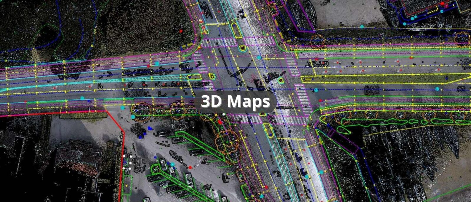
3D mapping using the mobile laser scanning (MLS) system enables precise imaging of three-dimensional models of terrain, buildings and other objects. This is done by scanning the environment with a laser scanner mounted on a mobile platform. This allows for quick and accurate analysis of topography and spatial structure under various terrain and environmental conditions.
3D map elements
3D mapping, based on a point cloud, allows for accurate mapping of real environmental elements such as:
Topographic elements:
- Terrain: Three-dimensional representation of the earth’s surface considering changes in elevation and topography.
- Contours: Contour lines representing the shape and slope of the terrain.
- Terrain relief: A representation of natural landforms, such as hills, valleys, ridges, based on point cloud data.
Urban infrastructure:
- Buildings and structures: Mapping of building ground surfaces, representation of architectural structures using point cloud, depicting their contours and shapes.
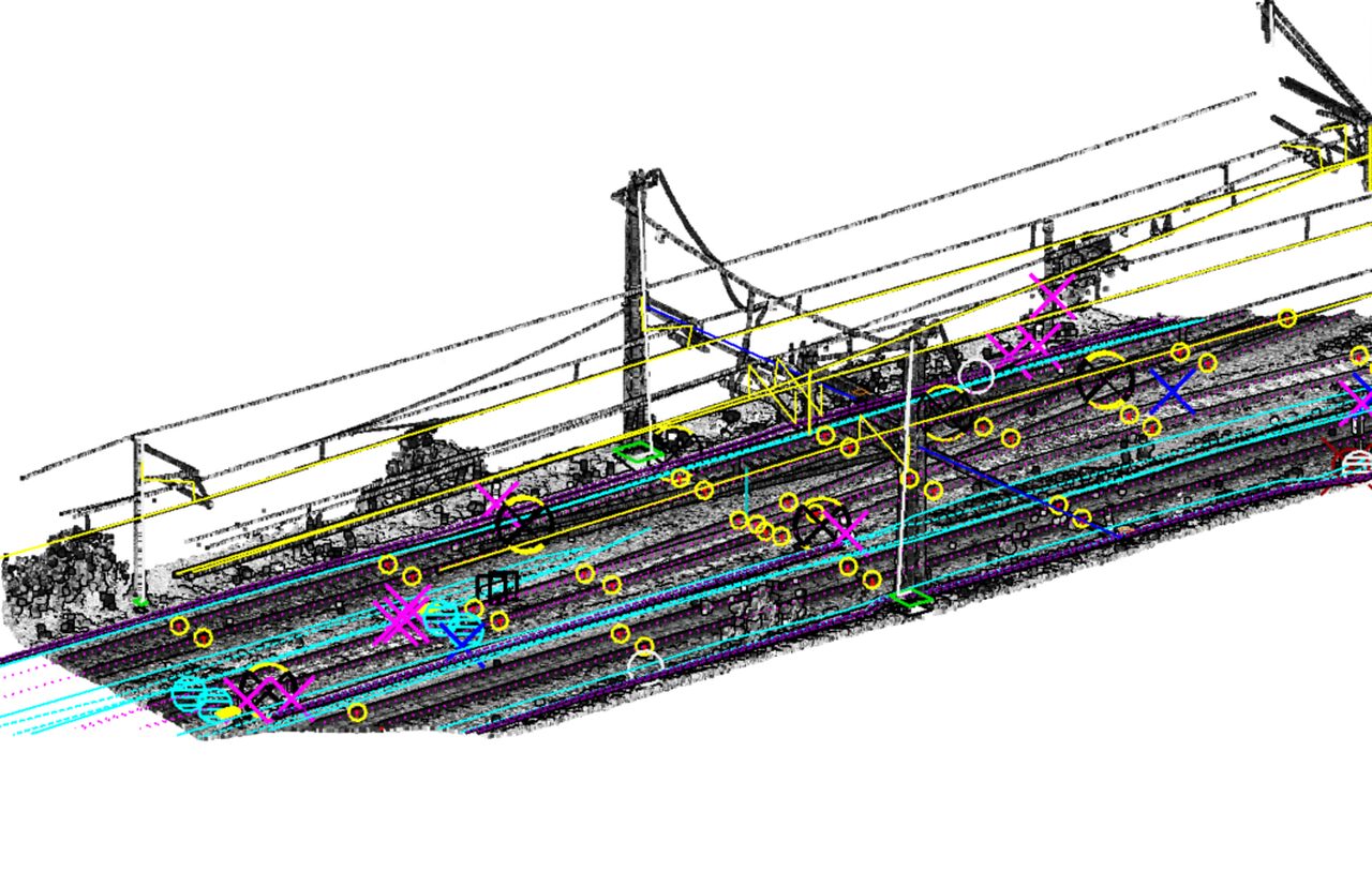
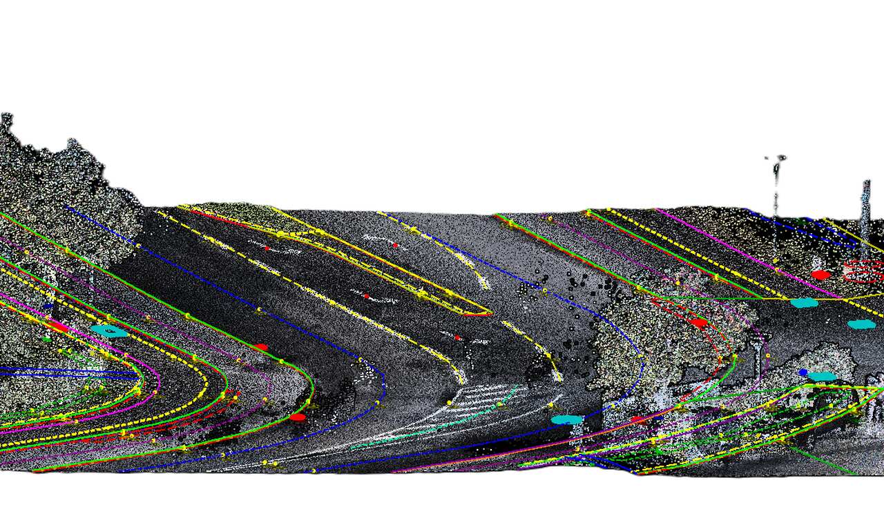
- Road and transportation networks: Accurately mapping roads, streets, curbs, sidewalks, bike paths, railway tracks, and other transportation infrastructure elements.
- Urban elements: Mapping of urban objects such as streetlights, road signs, benches, trash cans, manholes , grates, hydrant.
- Vegetation: Drawing in elements such as trees, hedges, etc.
3D mapping can be used to create accurate land models, monitor construction progress, and plan urban and road infrastructure. It also supports urban development planning through land use analysis.
Our offer
Progea 4D specializes in creating detailed 3D topographic maps using LiDAR acquired data. We create topographic drawings for residential areas, parking lots and roads, providing a comprehensive terrain analysis.