
In today’s world full of innovation and advanced technologies, LiDAR laser scanning (Light Detection and Ranging) stands out as an indispensable tool for creating accurate 3D models of our surroundings. No matter what industry you’re in, LiDAR laser scanning is revolutionizing the way we perceive, analyze and design the world around us.
How does LiDAR Laser Scanning work?
The basic principle of LiDAR laser scanning is relatively simple but effective. The LiDAR device emits laser pulses in different directions and then records the elapsed time from when the beam is sent to when it reflects off the surface and returns to the detector. Based on the time of flight of the pulse and the speed of light, LiDAR calculates the distance to the surveyed points on the surface. The received data can then be processed to create precise three-dimensional models.
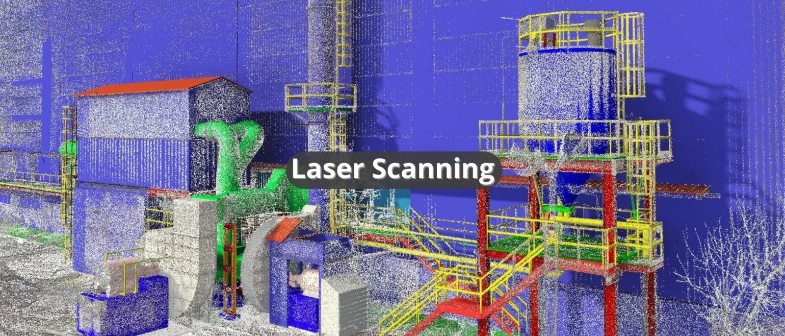
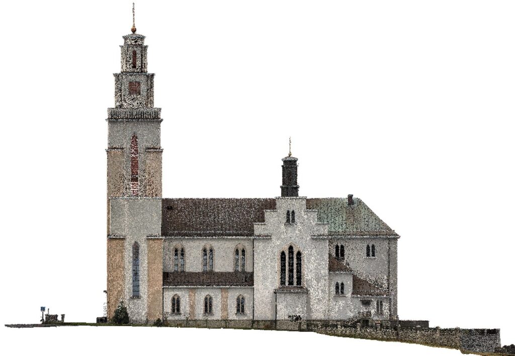
Data acquired from LiDAR laser scanning are often represented as so-called “point clouds”. This is a set of data represented by points on the surface of objects or terrain. Point clouds contain information about height, position, and intensity of light reflection which makes it possible to accurately reconstruct the shape and topography of the surveyed area. Analysis of point clouds is crucial for creating 3D models and conducting spatial measurements and analyses.
Benefits of LiDAR Laser Scanning
Laser scanning is becoming increasingly competitive compared to traditional measurement techniques due to the following advantages:
- precision – it provides accurate distance measurements, crucial for creating precise object models.
- speed – this technology works quickly, enabling for efficient data collection even from large areas in a short period time.
- accuracy – thanks to the high accuracy of measurements, laser scanning is extremely useful in many industries.
- versatile application – the colorful point cloud that can be obtained by laser scanning is perfect for all design activities, regardless of the specific area of application.
- detail reproduction – this technology allows for precise reproduction of even the smallest details of objects.
LiDAR Laser Scanning Applications
The applications of laser scanning are extremely diverse and cover many fields:
- cartography and terrain measurement – LiDAR laser scanning is used in land mapping terrain, both on a large scale and in detail. It makes it possible to accurately determine landforms, identify objects or pavement, and generate elevation maps.
- building and infrastructure modeling – in architecture and engineering, LiDAR laser scanning is used to create accurate models of buildings, bridges, roads, and other infrastructure facilities. Accurate data acquired with LiDAR enables designers to better understand existing infrastructure and terrain, leading to more accurate designs and more efficient construction processes.
- environment monitoring – LiDAR laser scanning plays a key role in environmental research and monitoring. It allows accurate measurements of tree heights, forest density, landforms and other environmental parameters, which is vital in understanding climate change, natural resource management and conservation.
- commercial and development applications – in addition to the above applications, LiDAR laser scanning is also used in many other fields, such as agriculture (e.g., for crop monitoring), archaeology (for research and documentation of archaeological sites).
What are the types of laser scanning?
- Terrestrial Laser Scanning (TLS) – this is a technique for collecting field data using advanced laser scanners mounted on tripods.
- Mobile Laser Scanning (MLS) – is a method of acquiring 3D information using a scanner integrated with moving platforms such as cars, trains or boats.
- Airborne Laser Scanning (ALS) – is a scanning technique in which laser scanners are placed on specially adapted aerial platforms, such as aircraft or drones, which fly over the scanning area.
We can import the acquired information into CAD or 3D applications, where it can be freely processed as a point cloud. In addition, the point cloud can be used for promotional activities, such as developing a visualization in the form of a video.
Terrestrial laser scanning is the most accurate scanning method It has become a key tool in We have advanced laser scanners that provide a point cloud in grayscale or RGB color palette, depending on your needs.
Laser scanning can generate data in formats such as LAS/LAZ, E57, RCP/RCS, POD and XYZ.
Thanks to terrestrial laser scanning, we are able to carry out work related to the measurement of buildings or their inventory in order to create a solid base for further activities, such as 3D modeling or creating models for BIM.