

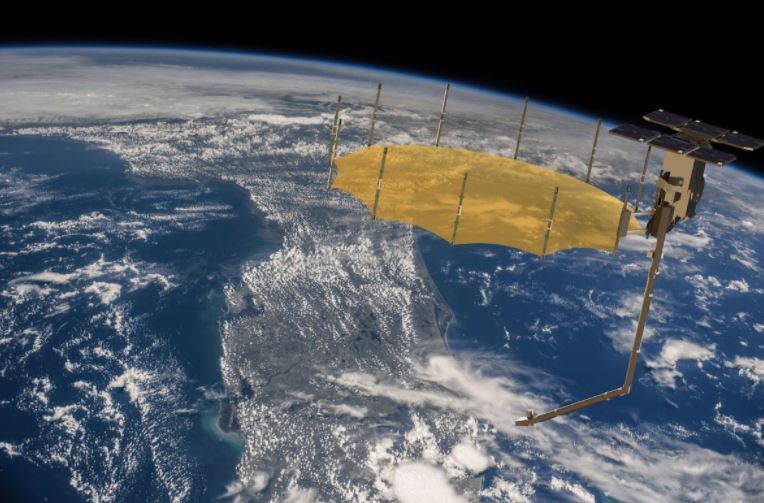
Capella X-SAR is an Earth observation satellite constellation collecting high-resolution X-band synthetic radar images (pixel size 0.3 m). Capella currently has the highest resolution commercial SAR in the world (50 cm x 50 cm) and is the first commercial SAR operator in the USA.
The constellation operates at an altitude of 485-525 km; aerial test imagery was collected over strategic sites beginning in 2018, while the first in-orbit imagery began in 2019. There are 36 satellites planned for the fleet, providing an hourly revisit time. With additional satellites scheduled to launch in the coming years, Capella plans to deliver high resolution SAR imagery at maximum 60 minute intervals! Where high resolution, data accuracy, and rapid response count, Capella X-SAR is the perfect fleet to assist in emergency response and inclement weather. To see more specific capabilities and project uses for Capella X-SAR please see the tables below.
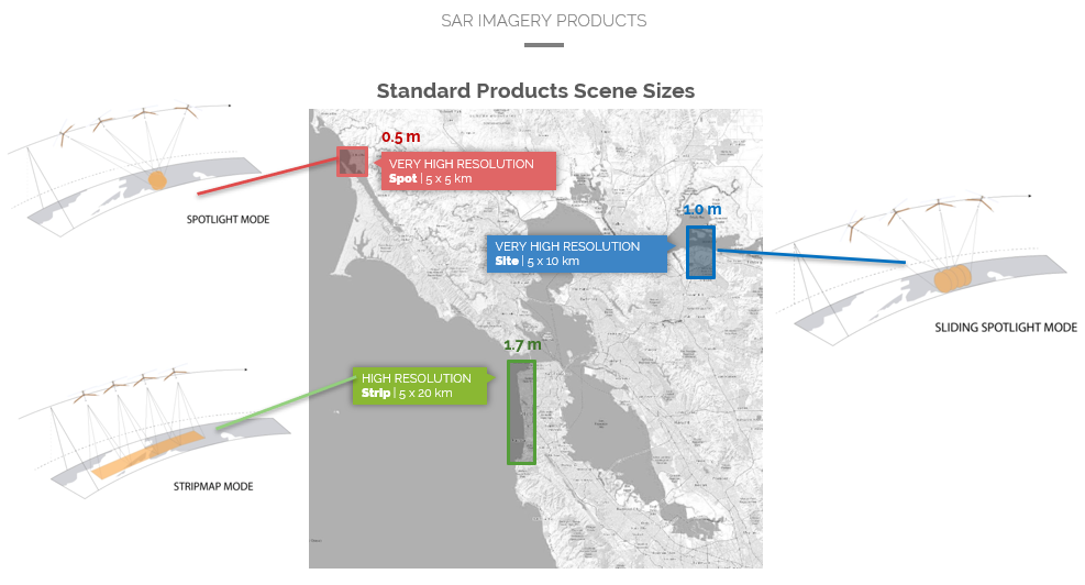
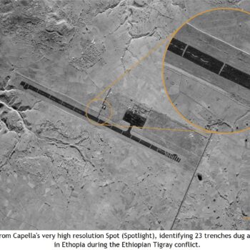
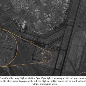
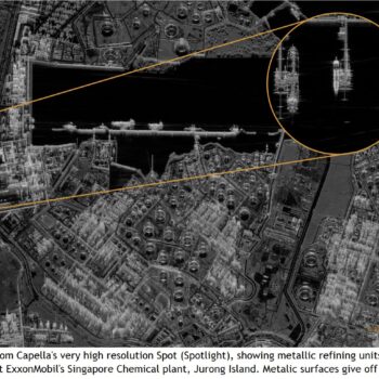
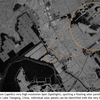
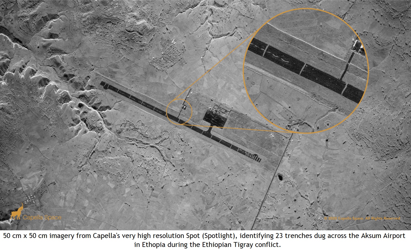
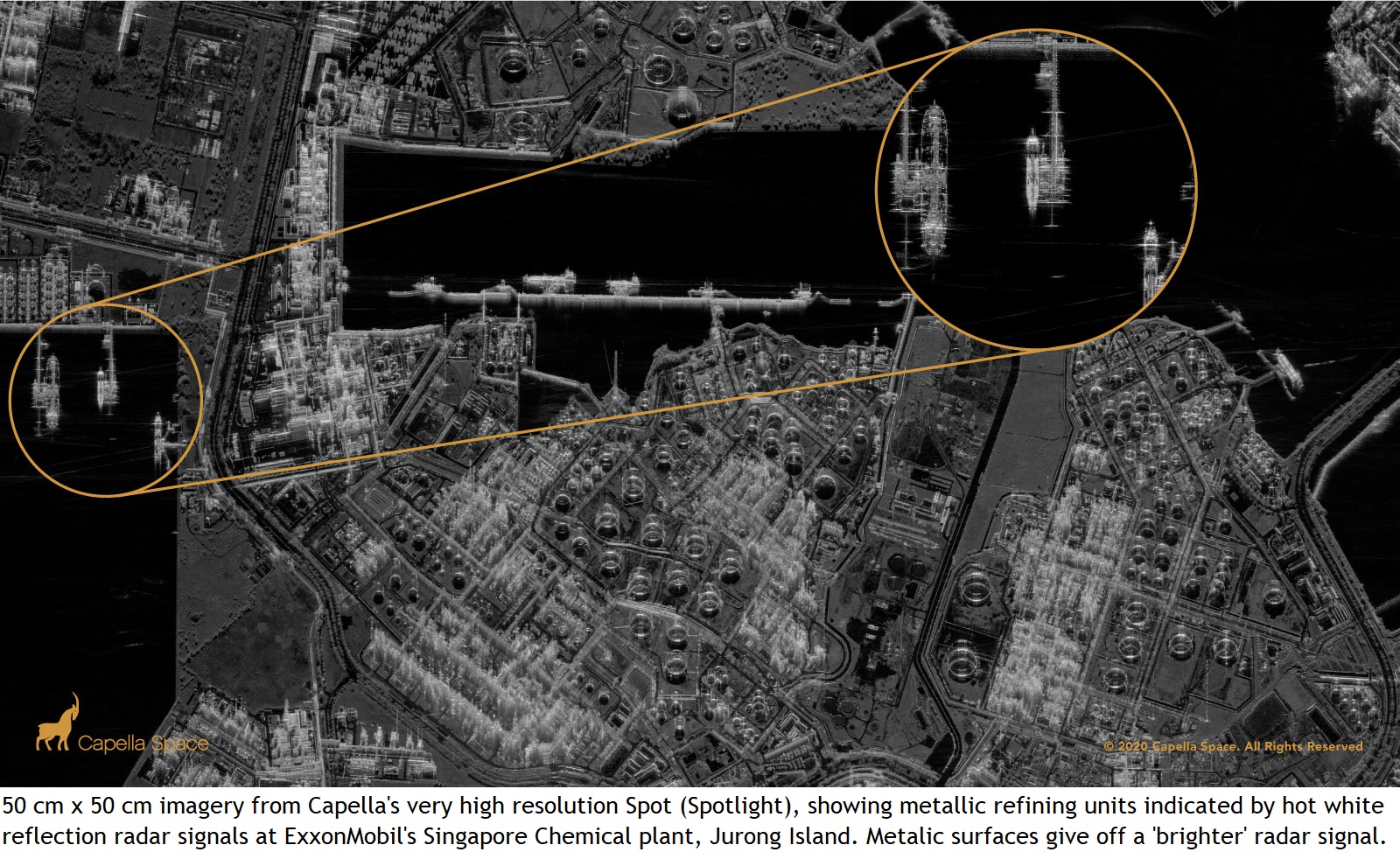
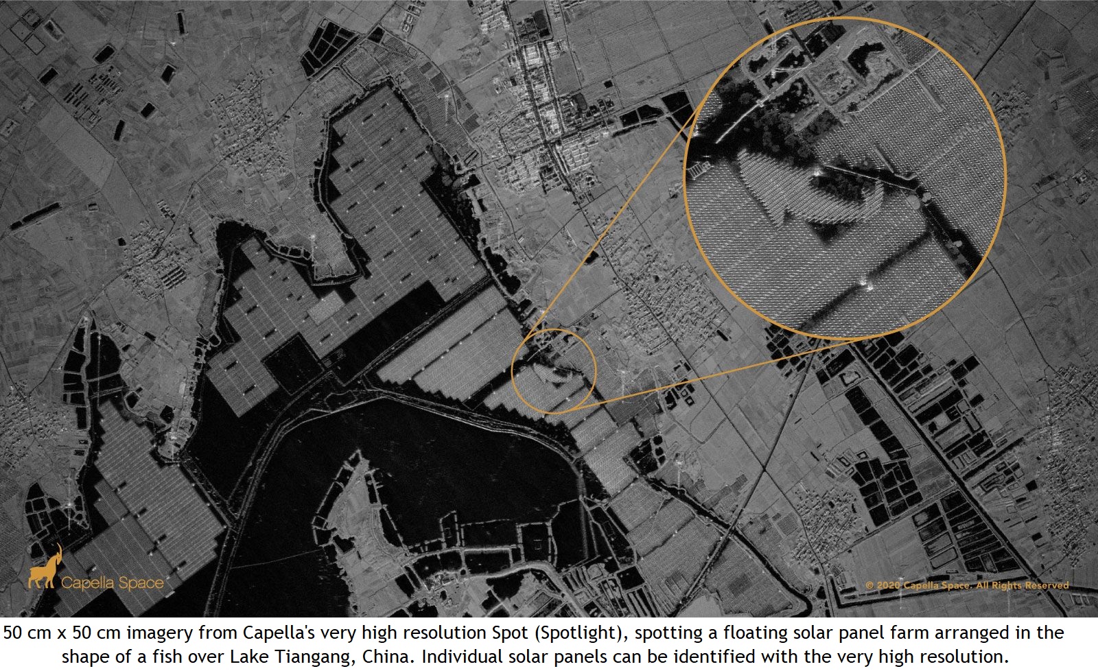
X-SAR products can be imaged in 3 modes: spot, very high resolution, useful for object detection and tracking commodities; site, very high resolution, useful for infrastructure and civil engineering, thematic mapping, and pipeline monitoring; or strip, high resolution, useful for disaster response, maritime operations, and environmental monitoring. Both site and strip modes can be imaged in a continuous stretch. Spot mode has an impressively high resolution with less speckle, but by the nature of the imaging technique, can only image one location per pass. All three modes have specific values that can be applied to specific project types.
Offered data formats:
1. SLC (Single Look Complex): the data contain the amplitude and phase of the radar signal and is dedicated to advanced processing. Images are available in GeoTIFF + JSON format.
2. GEO (Geocoded Terrain Corrected): the image contains only the amplitude information. The data are terrain-height corrected and multi-looked. The image is georeferenced to the WGS84 UTM regular grid.
3. GEC (Geocoded Ellipsoid Corrected): the product has been geocoded and projected onto the WGS84 ellipsoid with the use of the average scene center height. The image has not topographic correction. Due to multilooking, it is characterized by unmatched image clarity, spatial resolution and low noise.. In the case of relatively flat terrain, it guarantees excellent geolocation.
4. SICD (Sensor Independent Complex Data): format for sharing SLC productsin addition to GeoTIFF + JSON format. It is a U.S. national geospatial-intelligence (GEOINT) standard designed for the storage and dissemination of SAR data.
Contact us for any questions you may have regarding which mode is best for you.
Specification
Frequency band:
X-band (9.4 – 9.9 GHz)
Spatial resolution:
Spotlight: 0.5 m – 0.7 m
Sliding Spotlight: 0.8 m – 1.2 m
Stripmap: 1.6 m – 2.4 m
Revisit time:
max. 1 hour by 2022
Polarization:
Single polarization (HH)
Webpage: