From October 2015 to June 2016, under the contract with the Krakow City Hall and the cooperation of the Institute of Meteorology and Water Management in Krakow, we carried out works as part of the project entitled “Integrated system of spatial data monitoring for the improvement of air quality in Krakow – MONIT-AIR”.
The tasks of our company included, among others:
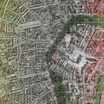
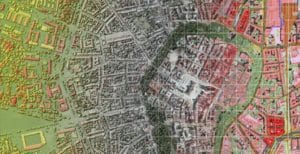
Preparation of digital maps of land cover and land use based on the general inventory of greenery along with the digital update of the “Map of real vegetation of the City of Krakow” – the result was the development of three detailed maps: 1) Map of land cover and roughness, 2) Map of greenery and ventilation conditions of Krakow, 3) Map of real vegetation;
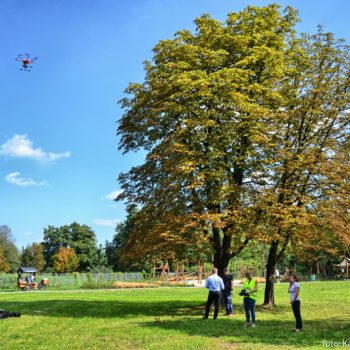
Performing a detailed dendrological inventory on 100 ha of characteristic types of urban greenery, i.e. parks, road lanes, lawns – the works included, among others, Planty, Krakowski Park, Jordan Park, Strzelecki Park, Trzech Wieszczow Avenue, Dietla Street, Pokój Avenue and most streets in I and II districts;
Processing of data from laser scanning of the Krakow surface and high-resolution multispectral satellite images for the needs of modeling meteorological fields;
Development and implementation of the R3 TREES computer system for greenery management enabling the collection and processing of information about green areas of the Municipality of Krakow and its integration with the Municipal System of Spatial Information (Polish abbrev.: MSIP);
Conducting trainings for employees of the Krakow City Hall on the use of spatial data and the use of the R3 TREES computer system for greenery management;
Editing of the study entitled “Atlas of land cover and ventilation of Kraków”, containing the full methodology of the works performed and all the results in the form of charts, tables and maps.
We encourage you to familiarize yourself with the maps resulting from the project on the MSIP website in the MONIT-AIR Atlas of Krakowa 2016 tab: http://obserwatorium.um.krakow.pl/obserwatorium/